SELLING

Agricultural Investment Services

- Selling -

Valuation Report With Sales

Helping create a complete picture enabling you to achieve a premium.

Achieving the maximum selling prices from your sale is important, but having the correct information before selling is also as important.

Fraser Valuers offer detailed market valuation reporting and mapping tools to ensure due diligence is undertaken. Reports include comparable sales to help create a complete picture enabling you to the achieve a premium.

Information Memorandum 

Building the whole picture of your property so your property is set apart from the rest.

We can provide extensive data and local knowledge, and are ideally placed to create a detailed Information Memorandum to maximize the potential selling opportunity. This can also include commentary around carbon abatement, water trading and resource development.

Property Benchmarking 

Using the latest of satellite data.
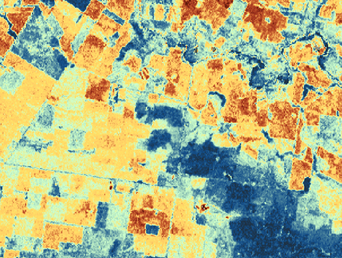
We can benchmark paddocks, neighbouring properties, recent sales, the district or even the state. Our tools can demonstrate to future purchasers the value in your property compared to the market. This is a great tool to enhance you IM, enabling a greater reach to more investors.

Using the latest of satellite data, tools and working with some of the largest producers in the country, we can tailor a report that will appeal and capture potential buyers utilising this information. 

Property Mapping

Our mapping tools integrate the latest weekly satellite vegetation.

Fraser Valuers have seen the importance of accurate property mapping tools, and we have invested in designing a custom made program that is both detailed and mobile to achieve this. Our valuers have access to the most recent data sets whilst out in the field, with further analysis once back in the office. Our mapping tool also integrates the latest weekly satellite vegetation and grass surveys. These tools help provide a complete overview of a property, providing the advantage over others when selling

Pasture Mapping

Weekly pasture data collected via a satellite for your property.
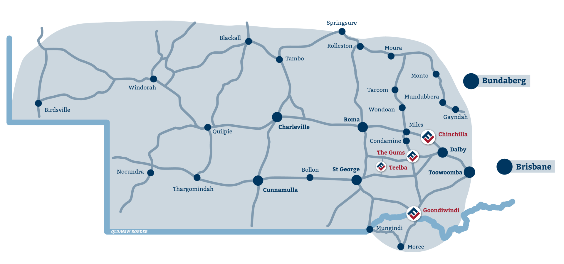
Most people are not aware that weekly pasture data is collected via satellite, Fraser Valuers have contracted an innovative company that supplies this data in a readable format. We utilise this information in our mapping system, and supply up to date, well researched property management techniques and benchmarking. Utilising this data sets us apart from the more dated information commonly available and enables our clients to access the latest data to make informed decisions.

Our Service Area

We are well positioned to service our client’s needs throughout the Local Government Authorities of: Toowoomba, Western Downs, Maranoa, Goondiwindi, Banana, Blackall Tambo, Murweh, Bulloo, Paroo, Quilpie, Balonne, Diamantina and Paroo, Tenterfield, Glen Innes, Amidale, Inverell, Gwydir, Tamworth, Moree Plains, Gunnedah, Walgett & Narrabri Councils areas.

Send us a message.

Looking to engage our services? Send us a message and we’ll be in touch. 

Share by: